Inshore Lite Map
$99.99+tax
All the features below – less real time water/wave data and chat rooms to share intel. Track your vessel anywhere on the planet – track other vessels out to 10 miles.
Inshore Plus Map
$299+tax
ALL the features below- track other vessels out to 10 miles.
For More Information Or to Sign up now – click here
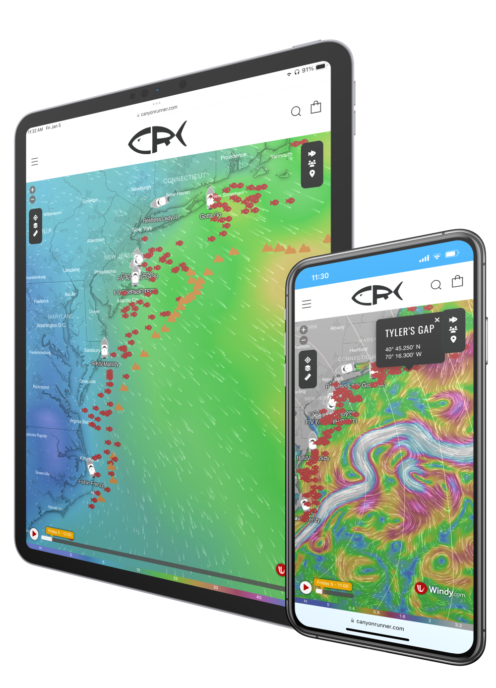
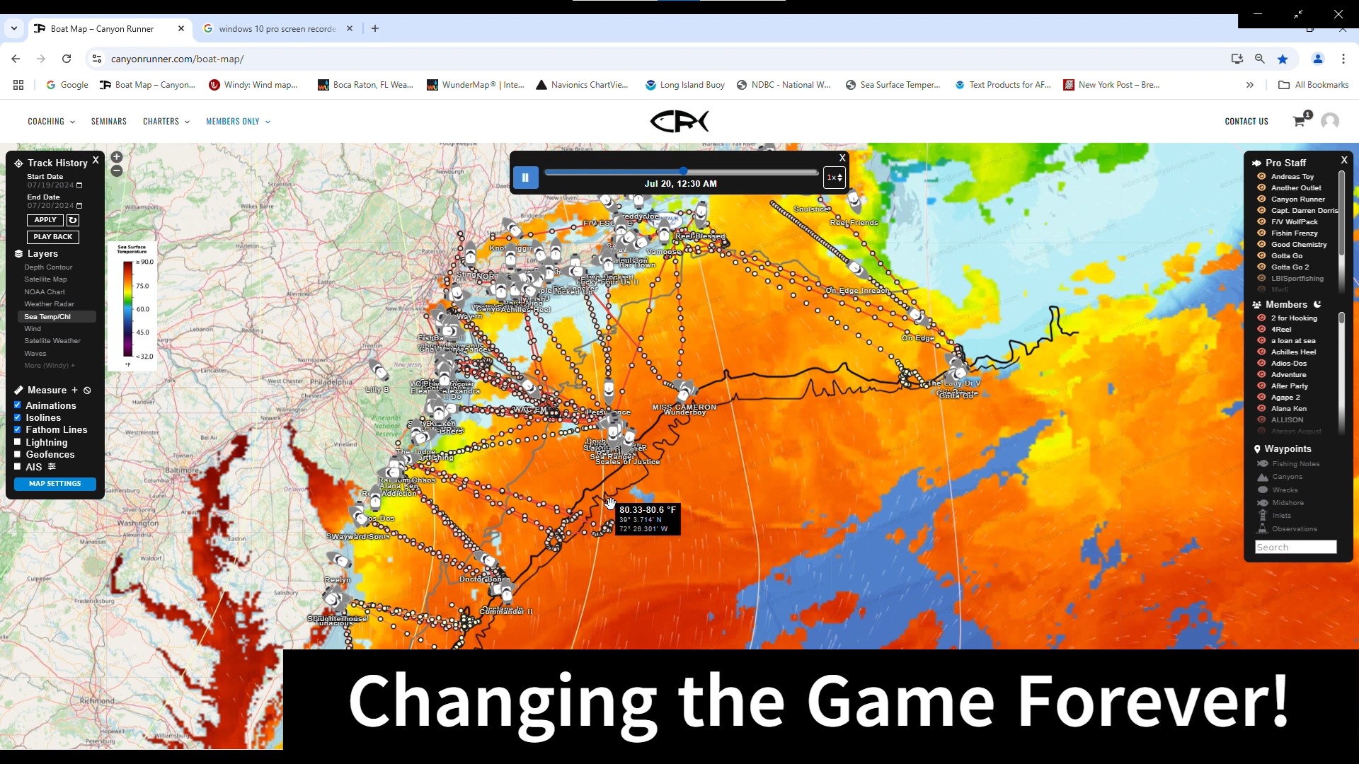
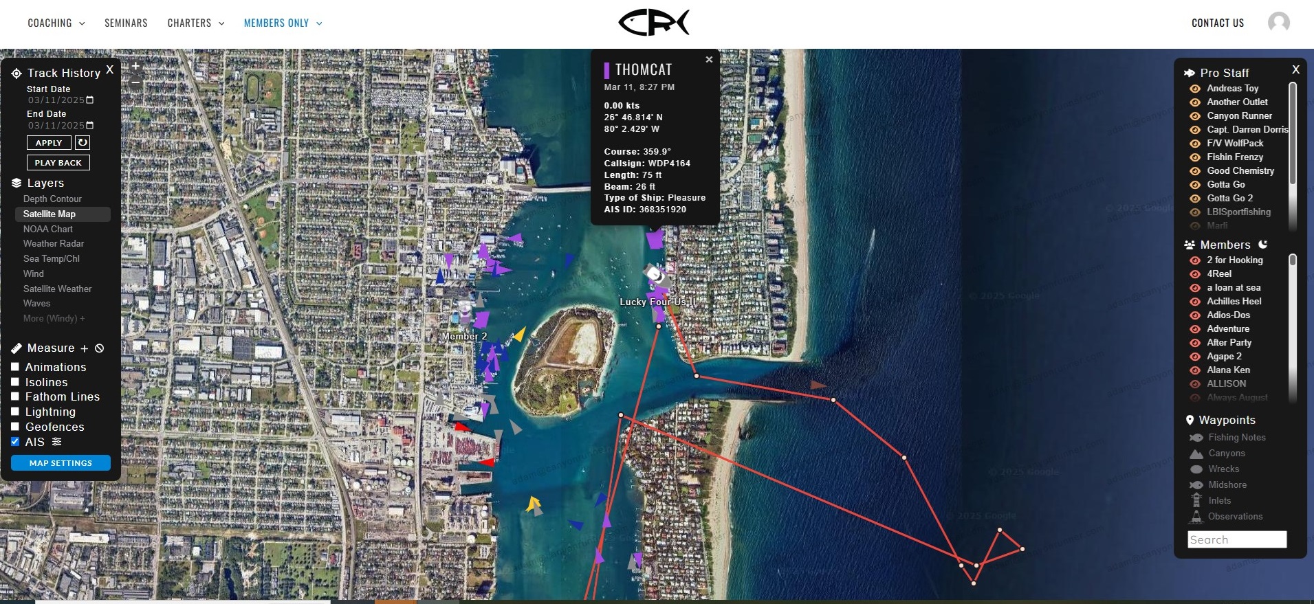
Virtual Captain Map & Track System – Changing the Game Forever
Track Your Vessel, All Members & Pro-Staff in Real Time!
Our Virtual Captain & Tracking Map effective serves as your co-captain – providing weather, water temp, enhanced safety & a built in warning system…..and so much more!
This system gives Members & Pro-Staff the ability to track each and every Member & Pro-Staff in real time on one page – one map – one website – One Helm!
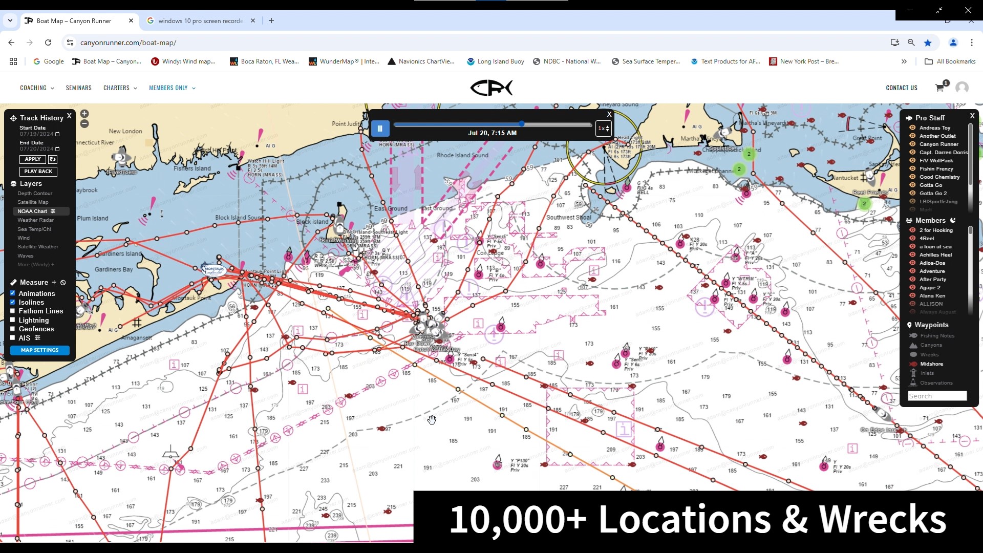
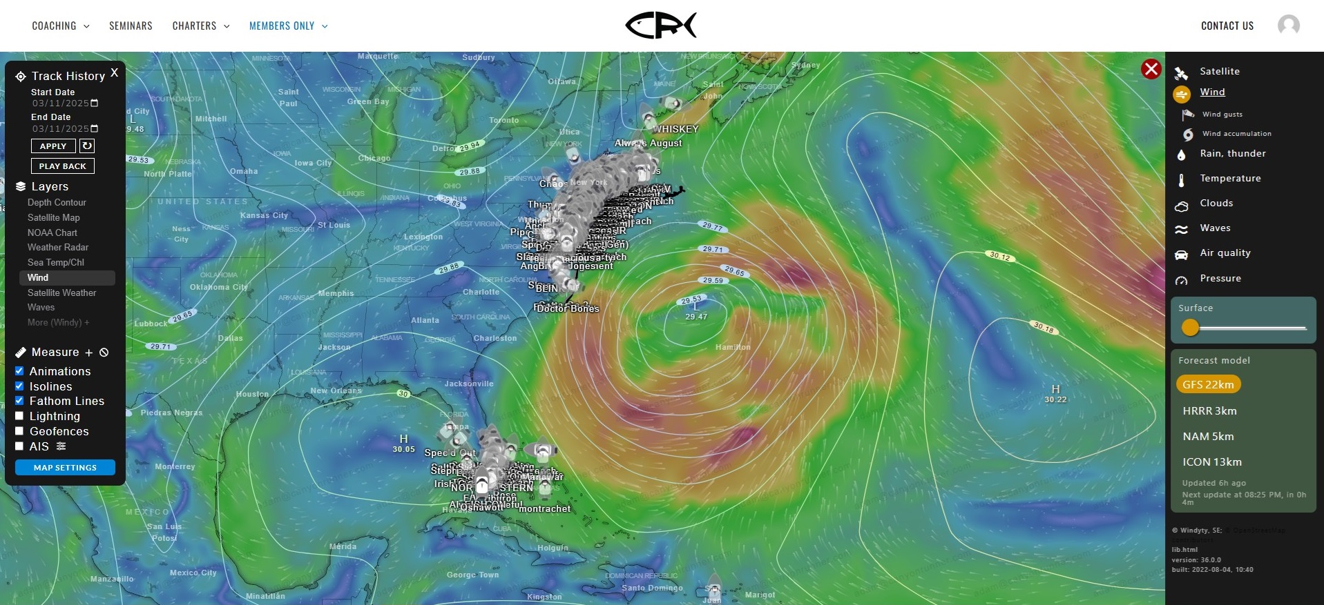
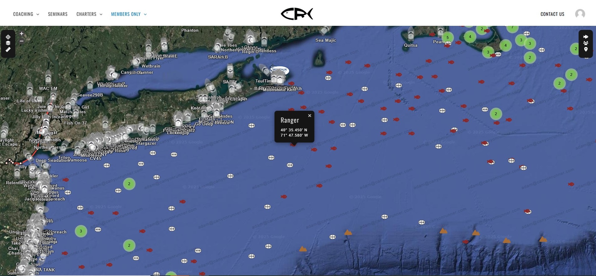
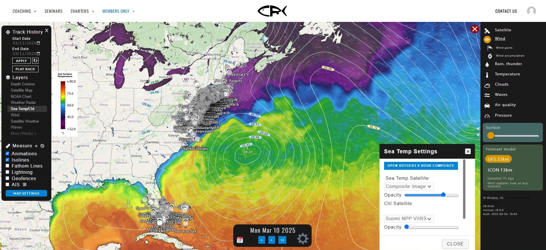
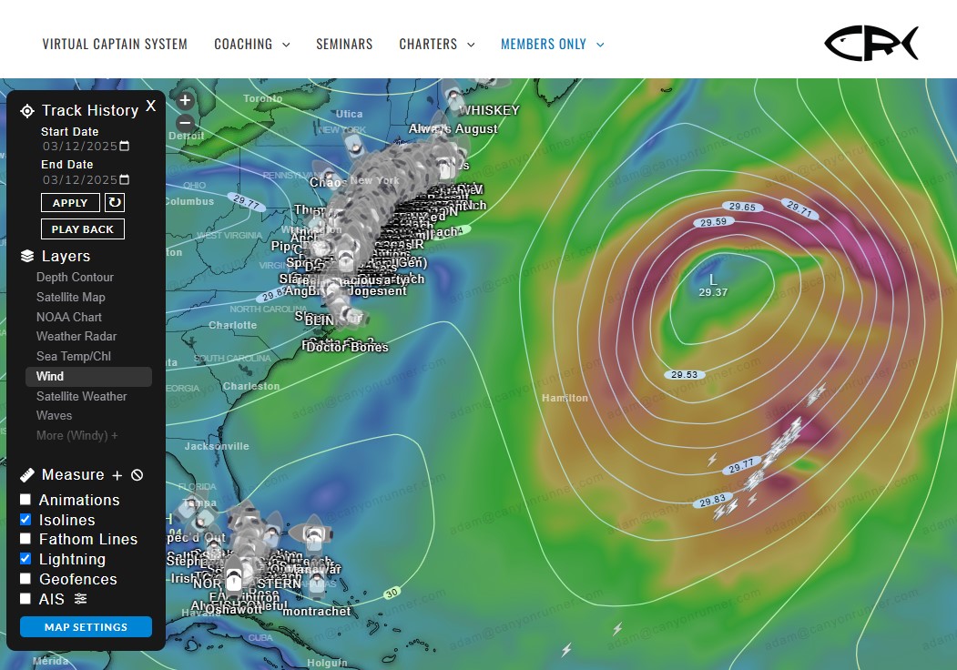
In addition to the boat tracking system – all on the same website/app – we have a water temperature chart system, Multiple Paid Weather Services, NOAA Buoys, 10,000+ Wrecks & Fishing Location, Multiple Chart Overlays, AIS tracking system in real time of the Longline and Dragger Fleet, a weather warning & avoidance system, a fleet monitor system, a boat monitoring system and a fishing log database – all in one – for your fishing and boating needs you’ll never need to leave our Map.
Weather
Water Temp
Intel
Historical Data
Safety
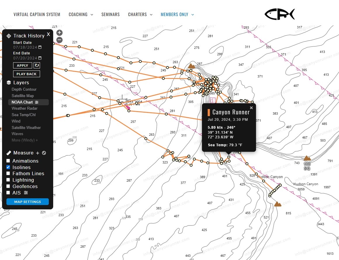
Real Time Location
Exact location of the fleet 24/7/365.

Historical Data
Keep track of where you and other boats have been fishing on past trips.
![]()
Wind
Multiple paid weather services overlaid over your boat and our charts/maps.

Wave
Real time and forecasted wave heights. Including actual wave heights off our 500+ boats while offshore

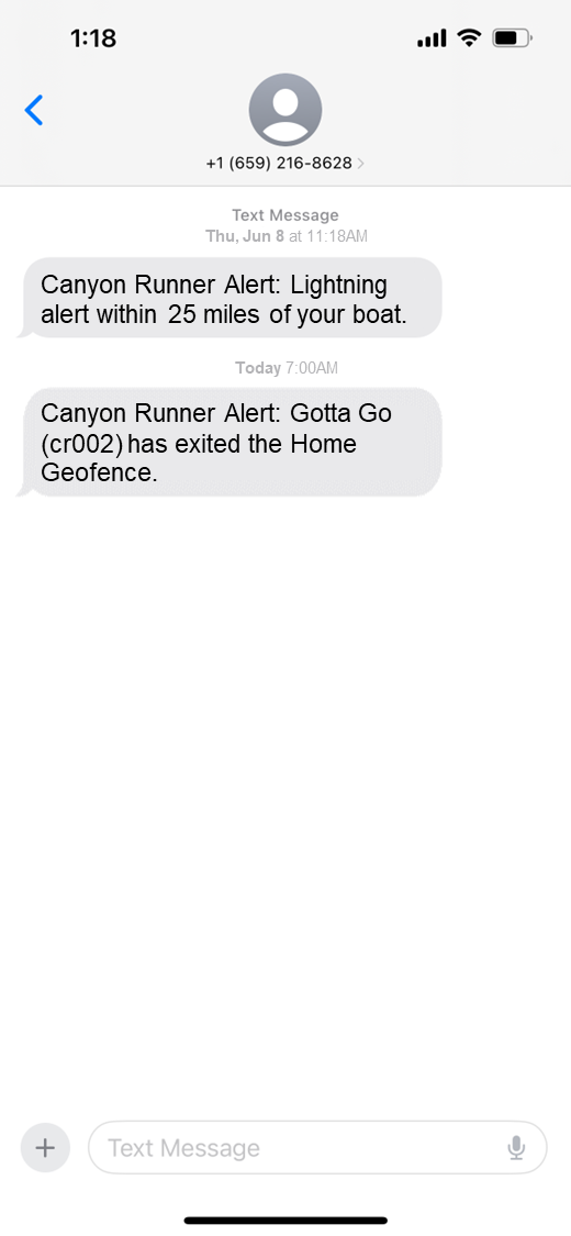
Lightning
Lightning tracking and warning system. Alerts texts to Members and Monitoring Service when any Lightning within 25 miles of your Vessel.
Fog
Real time and forecasted Fog Conditions & Alerts. Including forecasted and reported visibilities.
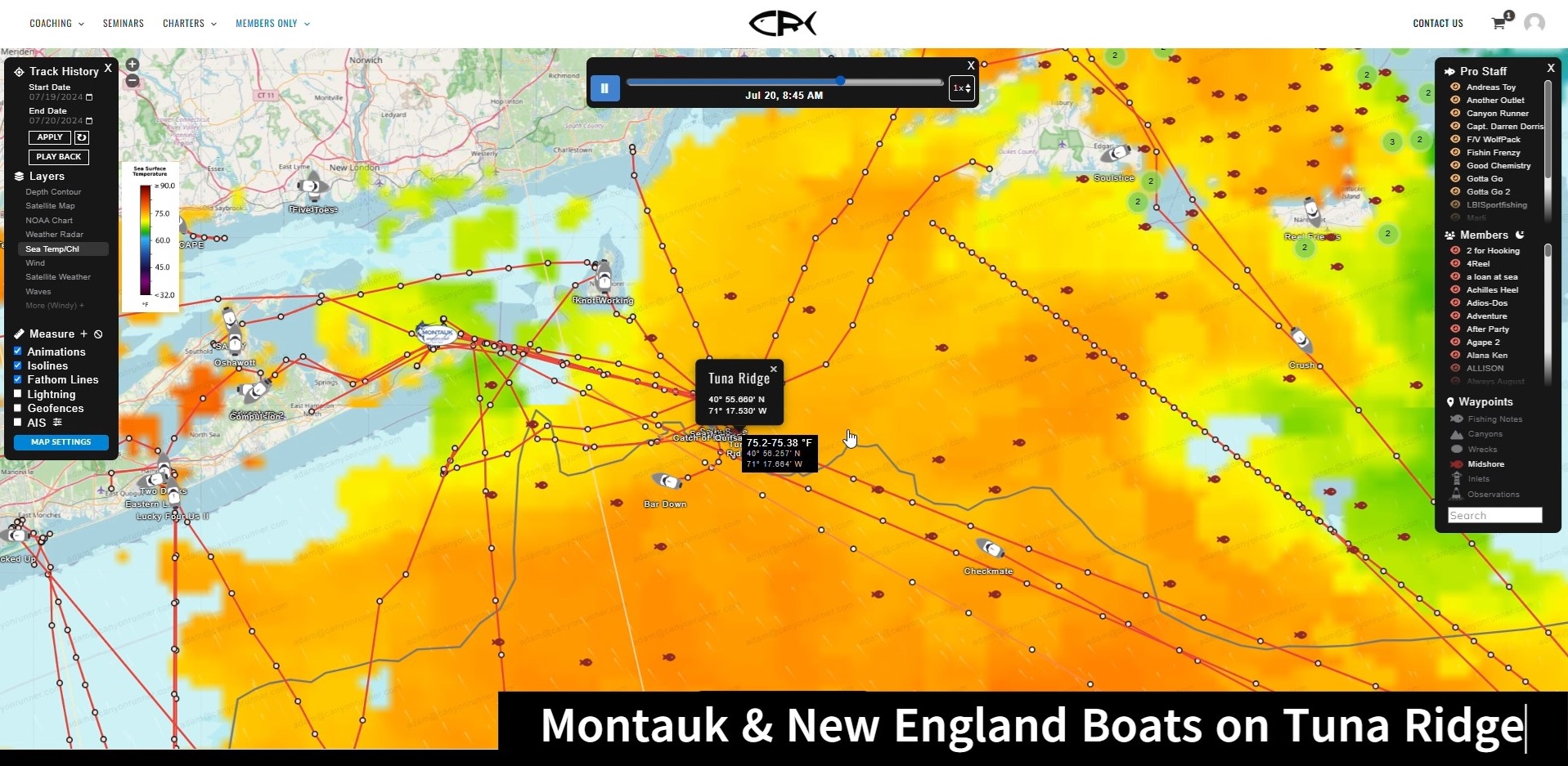
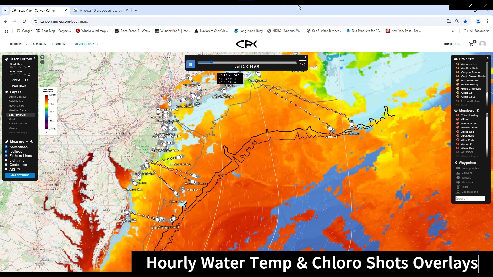
Water Temp Charts
Multiple daily detailed Water Temp Charts – with in-depth analysis from 40 years of experience.

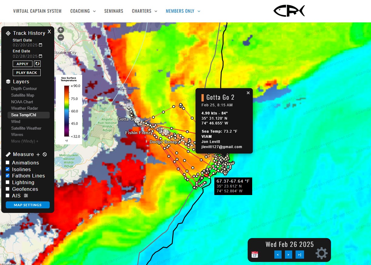
Actual Real Time Water Temps
See the actual real time water temps off our 500+ boats – no more worries about cloud cover.
Temp & Chlorophyll in Real Time
Overlaying real time actual water temps off our vessels – with water temp charts and chlorophyll charts – you’ll never need another chart again!
Share Intel
Sharing Intel in Real Time with Ease.

Real Time AIS
Keep track of all Vessels on the water – pleasure, fishing or commercial.
Mobile Friendly
Use it on your phone, tablet, or laptop with ease!