CR MAP

Changing the game forever

Track Your Vessel, All Members & Pro-Staff in Real Time!

Weather

Water Temp

Intel

Historical Data

Safety

Our Features

Real-Time Location

Exact location of the entire fleet – 24/7/365.

Historical Data

Keep track of where you and other boats have been fishing on past trips.

CR Historical Data

Wind

Multiple paid weather services overlaid over your boat and our charts and maps.

Wave

Real time and forecasted wave heights.  Including actual wave heights off our 500+ boats while offshore.

Lightning

Lighting tracking and warning system.  Alerts texts to Members and Monitoring Service when any Lighting within 25 miles of your Vessel.

Water Temp Charts

Multiple daily detailed Water Temp Charts – with in-depth analysis from 40 years of experience.

Actual Real-Time Water Temps

See the actual real time water temps off our 500+ boats – no more worries about cloud cover.

Temp & Chlorophyll in Real-Time

Overlaying real time actual water temps off our vessels – with water temp charts and chlorophyll charts – you’ll never need another chart again!

Pricing

FREE INSHORE LITE ACCESS UNTIL MEMORIAL DAY 2025!

Inshore Lite

$ 99
99 per year(plus tax)
  • Access to the maps and charts above
  • See Member / Pro-Staff boats up to 10 miles
  • No real-time water or wave data
  • No chatroom to share intel
  • No offshore coverage

Inshore Plus

$ 299
99 per year (plus tax)
  • All Inshore Lite features
  • A CR Box to receive boat data in the App
  • Real-time water and wave data
  • Chatroom to share intel
  • No offshore coverage
  •  

Offshore

$ 999
99 per year (plus tax)
  • All of the features, all of the vessels
  • No limit on range
  • A CR Box to receive boat data in the App
  • Real-time water and wave data
  • Chatroom to share intel
  •  

Your questions answered

Common questions

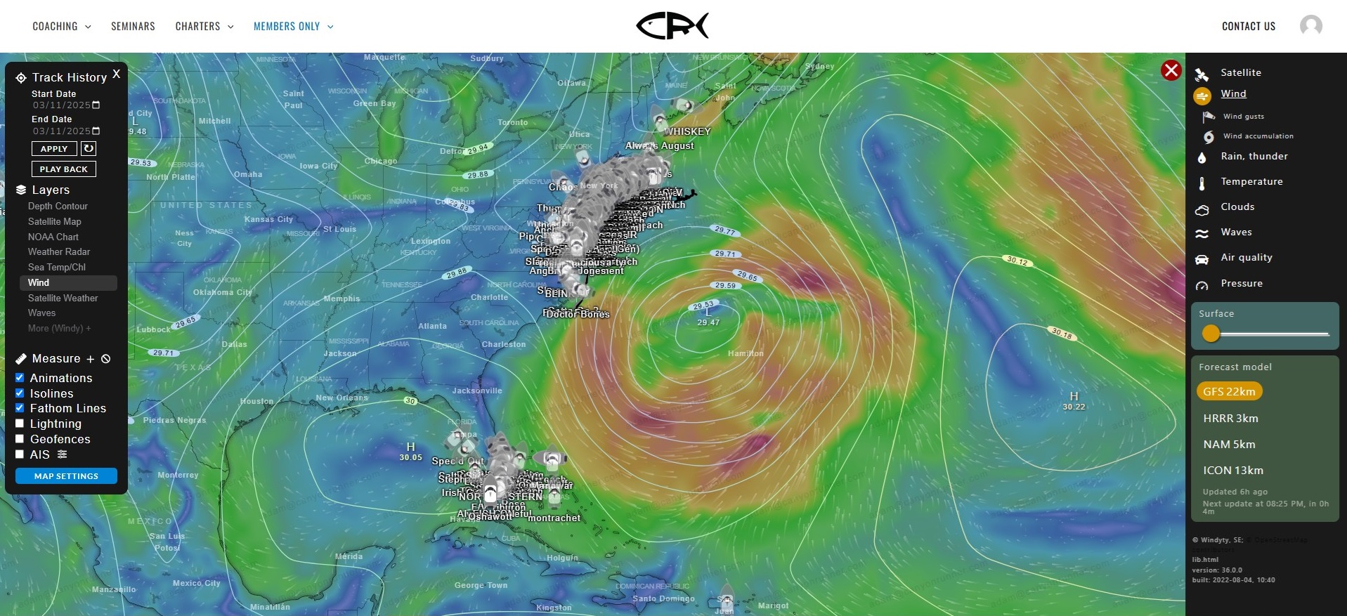
You can connect to the App and allow tracking via your cell phone network. If you are utilizing a CR Box, you can connect the box via wifi or Starlink if you are offshore.
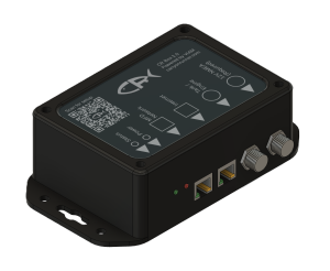
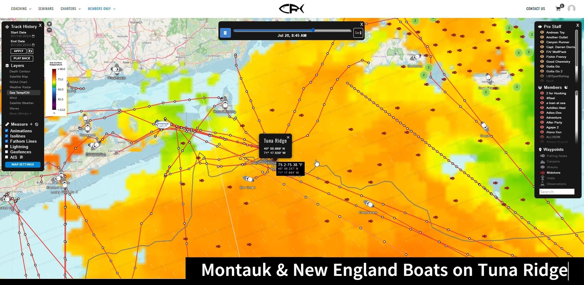
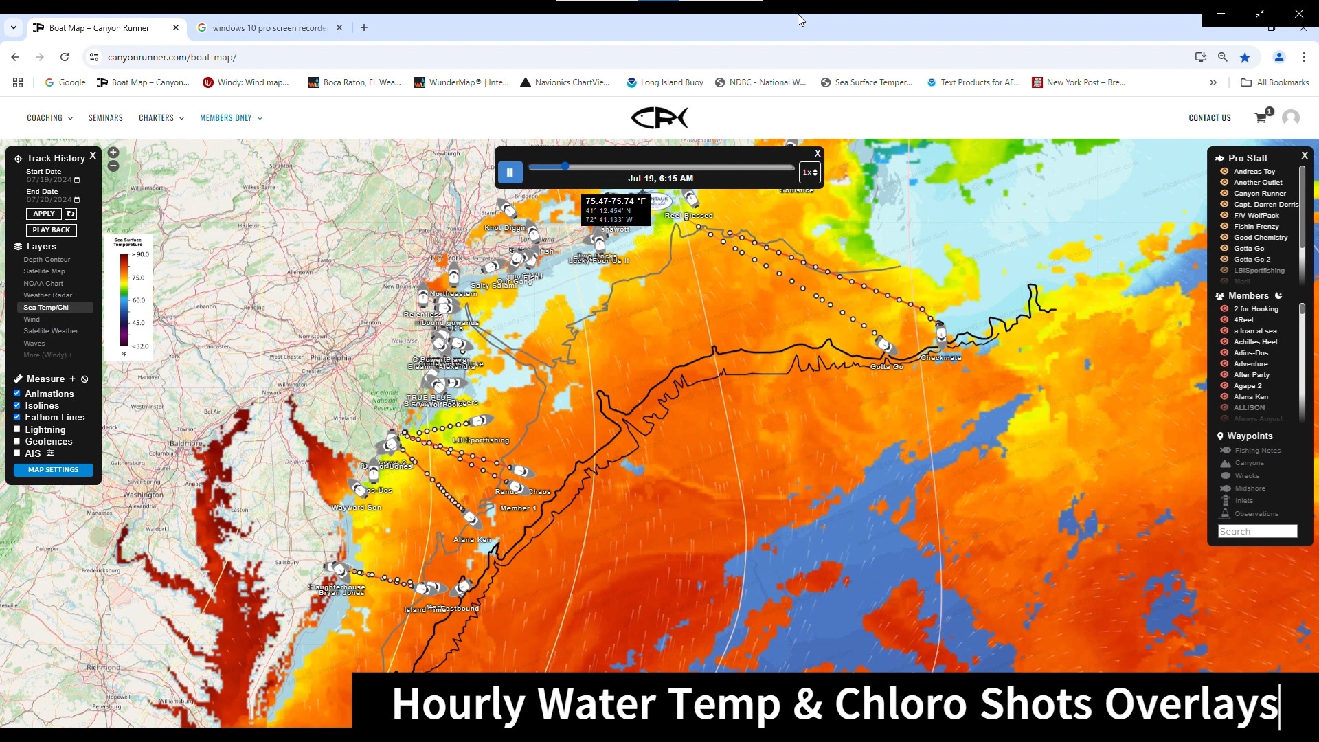
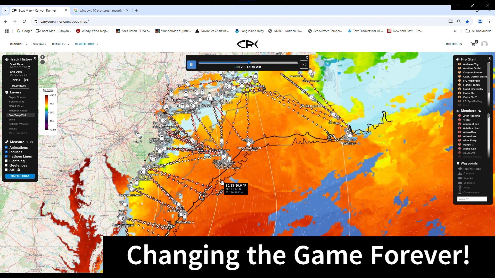
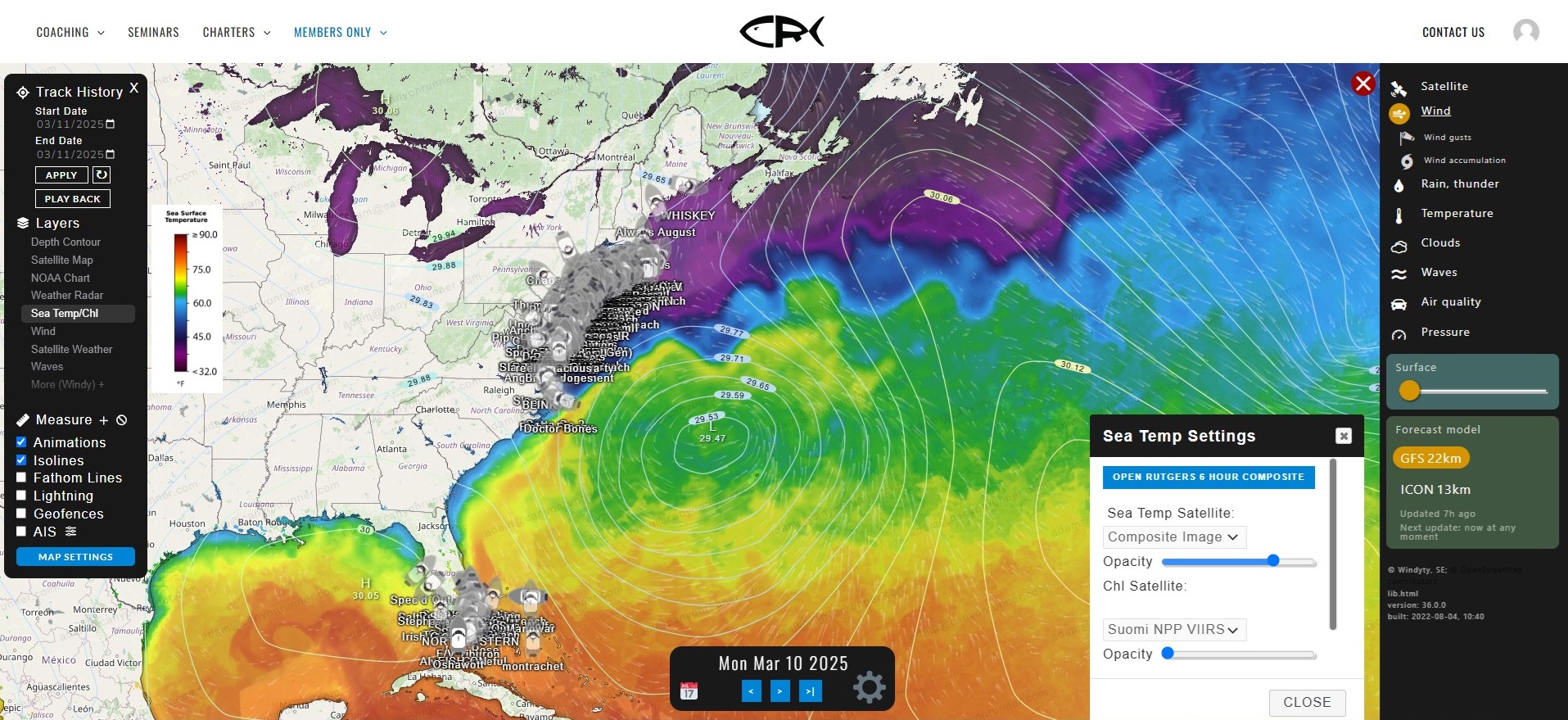
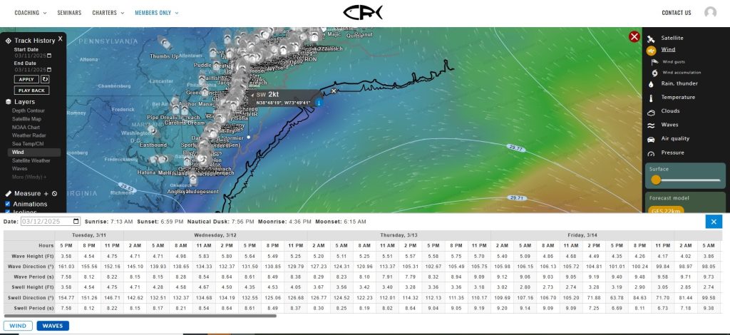
The CR Box is a connectivity system for your boat. The CR Box plugs into your boat’s NMEA backbone, and connects to all of the electronics on the NMEA network. This lets you transmit GPS, wave height, sea surface temperature and more make your CR Map experience even better.

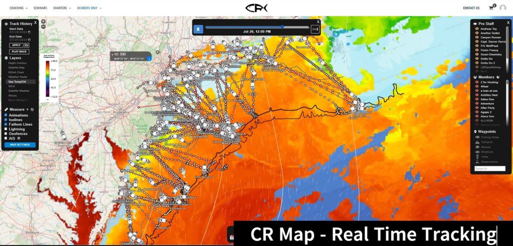
No problem! Even if you don’t go offshore, the CR Map can deliver a ton of value to you! With the Inshore and Inshore Plus plans, you can access our maps, charts and intel up to 10 miles offshore.  All at a fraction of the cost.

Get Started

For Apple
Devices

For Android
Devices

For Web
Browsers

Shopping Cart